Ladakh's High Passes: Travel Above the Clouds
Reference library · 987 words
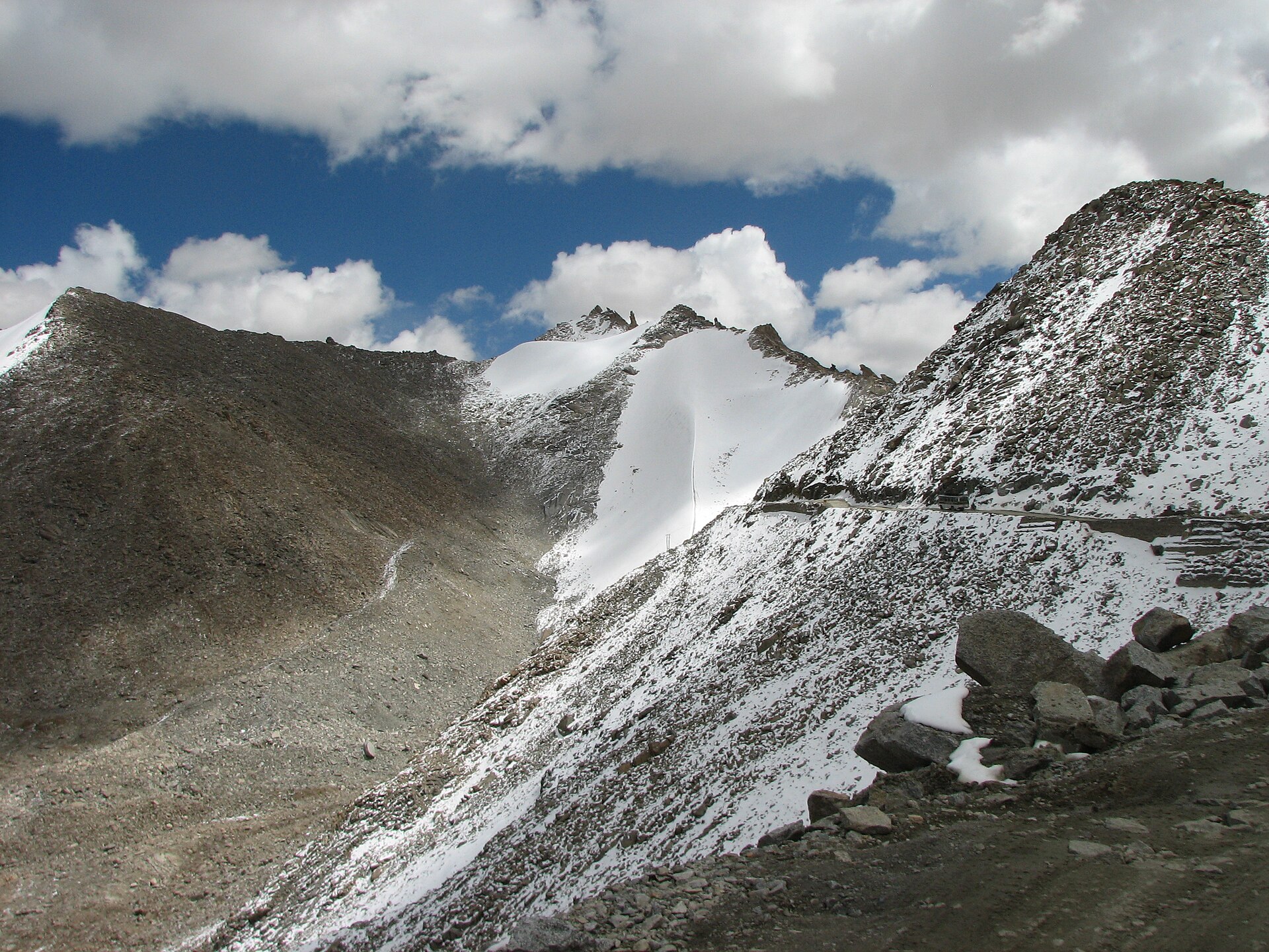

The name Ladakh is usually translated as the land of high passes, and the translation is a fair description of how the region works. Lying in the rain shadow north of the main Himalayan range, between the Zanskar and Karakoram mountains, Ladakh is a cold desert: brown, almost treeless, with villages surviving as green islands wherever glacial meltwater can be channelled to fields of barley and apricot. Because the valleys run in parallel and the ridges between them are enormous, almost every journey involves crossing a pass, a la in the Tibetan-derived local language. Khardung La, Chang La, Tanglang La, Fotu La, Baralacha La: the suffix is the geography.
Ladakh became a Union Territory of India in 2019, administered directly from Delhi rather than as part of Jammu and Kashmir. Leh, its main town, sits at roughly 3,500 metres in the Indus valley, and almost everything a traveller does begins there.
The two roads in
Two overland routes reach Leh, and both are seasonal. The Srinagar to Leh highway crosses Zoji La, a notoriously narrow gorge pass above Sonamarg where the road is cut into cliff, then climbs to Namika La and Fotu La, the highest point on that route, before descending past Lamayuru, whose eroded lake-bed sediments are marketed locally as moonland. This road opens earlier in the year because its passes are lower, and it has the gentler altitude profile, which makes it the better choice for anyone concerned about acclimatisation. A tunnel under Zoji La has been under construction for years with the aim of keeping the route open through winter.
The Manali to Leh highway is the more dramatic and the more punishing. From Himachal Pradesh it now passes beneath Rohtang Pass through the Atal Tunnel, opened in 2020, which removed the worst bottleneck on the route. Beyond that come Baralacha La, the Gata Loops (a stack of hairpin bends climbing the flank of a valley), Nakee La, Lachulung La, the strange flat expanse of the More Plains, and finally Tanglang La before the drop into the Indus valley. Much of this road runs above 4,500 metres for hours at a stretch, and there is essentially nothing along it: a handful of seasonal tent camps at Sarchu and Pang, no permanent settlement, no hospital. Both highways are built and maintained by the Border Roads Organisation, whose cheerfully alarming roadside signs about speed and mortality are part of the experience.
Passes to the outlying valleys
North of Leh, Khardung La carries the road into the Nubra valley. Its summit board has for decades announced a height of 18,380 feet and the title of the world's highest motorable pass. Both claims are disputed: satellite and survey measurements consistently put the pass closer to 17,600 feet, and several roads elsewhere in Ladakh and Tibet are higher. The Border Roads Organisation now promotes Umling La, in the Demchok sector near the eastern frontier, as the world's highest motorable road at well over 19,000 feet. Travellers should treat all such superlatives as contested marketing rather than settled fact.
Nubra itself rewards the climb. The valley floor holds cold sand dunes at Hunder where double-humped Bactrian camels graze, descendants of the caravan animals that worked the Central Asian trade routes to Yarkand and Kashgar before the closure of those frontiers ended the trade. Diskit monastery looks down the valley from a spur, with a very large modern statue of the Maitreya Buddha below it.
East of Leh, Chang La leads to Pangong Tso, a long, narrow, intensely blue lake at roughly 4,250 metres that lies partly in India and partly in Chinese-administered Tibet. It is salty, freezes solid in winter, and has been badly served by its own fame since appearing in Hindi cinema. Further south, Tso Moriri sits in the Changthang plateau, a wetland of international importance under the Ramsar Convention and a breeding site for the black-necked crane. The Changpa, nomadic pastoralists of the plateau, herd the goats whose undercoat becomes pashmina.
Altitude is the real hazard
The single most important thing to understand about travelling in Ladakh is that the danger is not the road but the air. At Leh's altitude the atmospheric pressure is roughly two thirds of that at sea level, and flying in from Delhi delivers a traveller to that pressure in about ninety minutes. Acute mountain sickness (headache, nausea, breathlessness, disturbed sleep) is common; its severe forms, fluid on the lungs or swelling of the brain, are rare but can kill quickly. The universally recommended precautions are simple: spend two full days resting in Leh before going higher, ascend gradually, drink water, avoid alcohol on arrival, and descend immediately if symptoms worsen. Medication such as acetazolamide is often discussed, but it is a matter for a doctor before travel, not for a travel article. Ladakh's remoteness means that evacuation from a high pass takes hours at best.
Season matters just as much. The Manali highway is typically open only from roughly late May or June until October, depending on snow, and the Srinagar route a little longer. Winter travel is possible by air, and has its own following: the frozen Zanskar river walk known as the Chadar trek is undertaken in January and February, though warming winters have made the ice less reliable and the route is now regulated. Permits, in the form of an Inner Line Permit for Indian visitors and a Protected Area Permit for foreign nationals, are required for Nubra, Pangong, Tso Moriri and the Dah-Hanu villages, and are arranged in Leh.
Between the passes lie the monasteries: Thiksey, tiered above the Indus like a small Potala; Hemis, the wealthiest of the Drukpa foundations, whose masked cham dances draw crowds each summer; and Alchi, unusual in being built on flat ground and unusual again in preserving wall paintings in a Kashmiri idiom from around the eleventh to thirteenth centuries, among the oldest surviving Buddhist murals in the western Himalaya.
References
- Encyclopaedia BritannicaLadakh
- Encyclopaedia BritannicaHimalayas
- Centers for Disease Control and PreventionCDC Travelers' Health
- Ramsar Convention on WetlandsThe Convention on Wetlands
This is a reference article, written from the sources above. It is background, not news reporting.